 Sierra Nevada Backpacking, 2003
The Sierra High Route, Italy Pass to Piute Canyon
Click on any image to enlarge.
|
My 2003 Sierra trip was a solo, 3-day backpacking trip that followed a segment of the Sierra High Route. The High Route is described in detail
in the Sierra Club totebook, I had travelled sections of the High Route twice before. In 1993, I covered the southern 60 miles of the route from Kings Canyon to Dusy Basin. In 2000, I intended to cover the 60 miles from Mammoth Lakes south to Piute Canyon, but aborted that trip midway through due to illness and exited early over Italy Pass to Pine Creek. This year (August, 2003) I went back to finish that trip and entered the backcountry over Italy Pass, picked up the High Route at Bear Lakes Basin and walked it southeast to Piute Canyon. Click below for descriptions and photos from my previous two High Route trips: 1993: Cedar Grove to Dusy Basin 2000: Mammoth Lakes to Italy Pass |
August, 2003
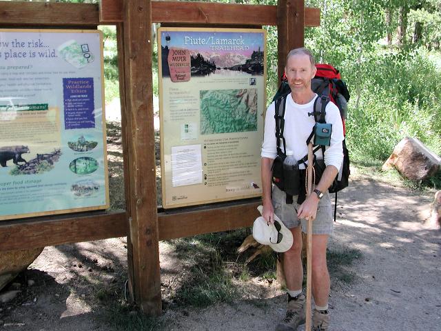
My 2003 High Route backpacking trip began at Pine Creek, 10 miles north and 10 miles west of Bishop. Before I could actually begin hiking,
a car shuttle was in order since my entry and exit trailheads were separated by 35 road miles. I drove from my home in Phoenix to the
Piute Pass trailhead at North Lake, near Bishop, CA, where I planned to end my trip. I had arranged in advance for a paid shuttle driver to
pick me up at this trailhead and take me to Pine Creek, where I would start hiking. The shuttle came off successfully and at 5:30am on
Tuesday, August 5, the hike began.
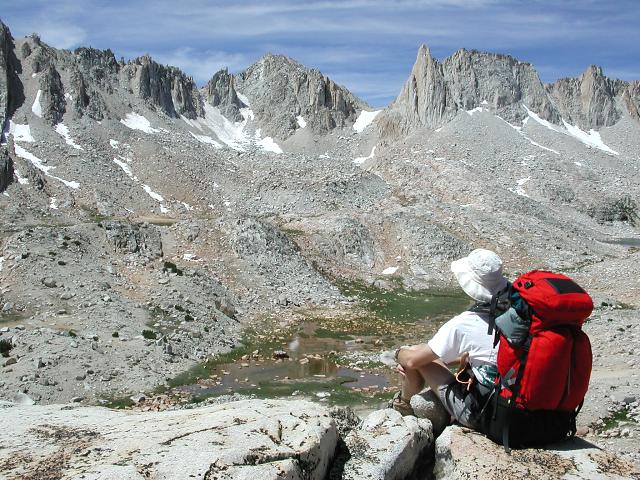
My first day was going to be long and tiring, thus I trained hard, kept my pack relatively light (39 lbs) and started early (5:30am). My first night's destination would be Bear Lakes Basin, approximately 12 miles distant, but to get there I would first have to climb over 12,350' Italy Pass, which required an elevation gain of about 5000'. I felt ready and was buoyed by my many successful climbs out of the Grand Canyon, which typically involved similar elevation gains.
Day 1: Pine Creek Trailhead to Bear Lakes Basin
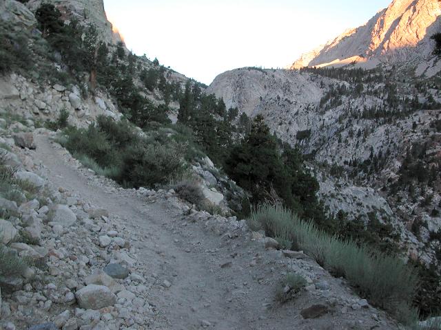
Sunrise was still 30 minutes away when I began hiking and it was just light enough to see the trail without a flashlight. The trail begins at the Pine Creek Pack Station and follows an old mining road for the first 3 miles as it switchbacks up a barren, treeless hillside. I was glad to be climbing this section in the shade since it could have been very hot in the brilliant California sun.
 |
 |
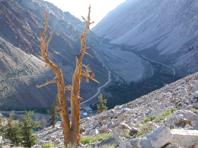 |
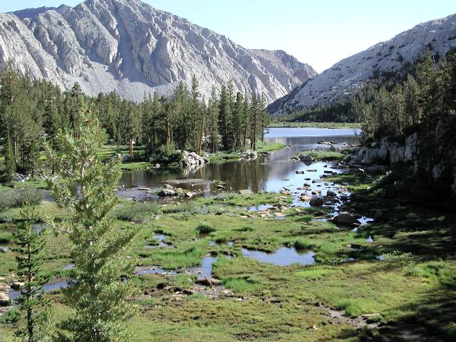
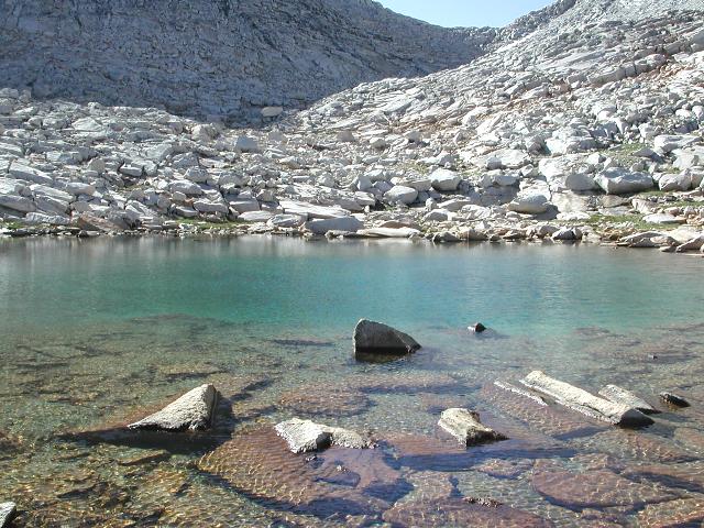
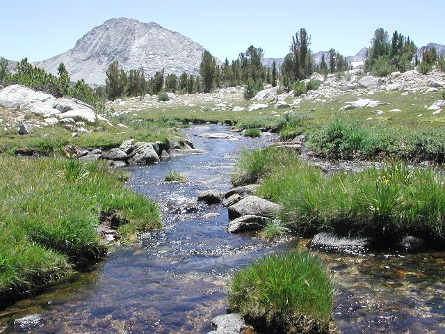
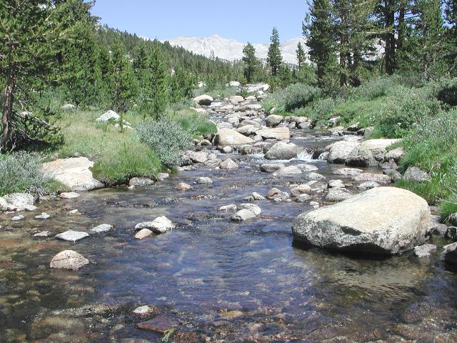
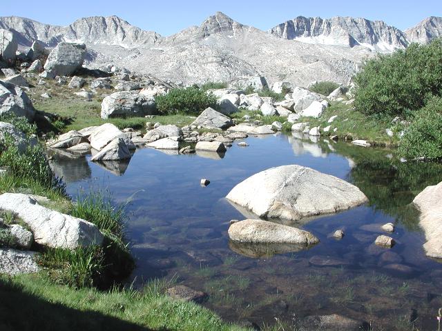
After 1-1/2 hours, the mining road gave way to trail. More climbing brought me up onto the bench that is home to Lower Pine Lake. At this point, I left behind the ugly mining area of lower Pine Creek Canyon and entered the Sierra wonderland of lakes, meadows and forest. First up was Lower Pine Lake, which appeared as a shimmering jewel in the early morning light. After working my way around this lovely lake, I soon came to Upper Pine Lake, which was still shaded at this early hour. I continued on and quickly came to the junction where the Pine Creek Pass Trail splits off from the Italy Pass Trail. Sticking with the Italy Pass Trail, I soon arrived at Honeymoon Lake, elevation 10,400'. I had already "conquered" 3000' of the day's 5000' total elevation gain and still felt good.
 |
 |
 |
During the next hour I ascended into lovely Granite Park, which is a stunning land of green meadows, beautiful lakes and gorgeous high peaks. I remembered how beautiful this area was from my previous trip and was eagerly anticipating seeing it again. As before, it nearly took my breath away. Either that, or it was the strenuous climb into higher altitude. I took my time walking through Granite Park and soaked in the views.
 |
 |
 |
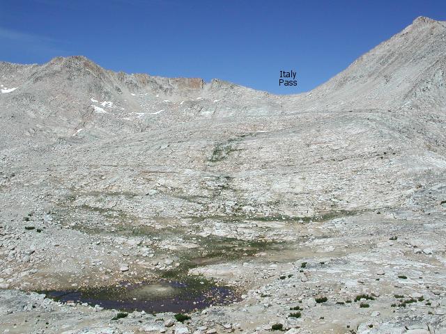
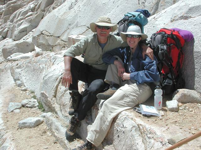
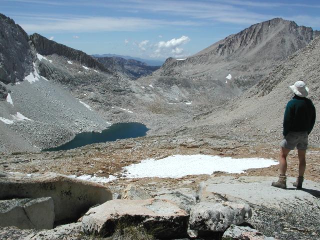
Soon Italy Pass was beckoning on the horizon and I struggled up the boulder-strewn slope to reach it by early afternoon. Just below the pass, I met Darryl and Sue from the Bay area, sitting and enjoying the fine day. They had just come from Bear Lakes Basin, which was my destination for the night, and had been impressed with its beauty. After a 20 minute visit during which I was glad to rest, I climbed the last few dozen feet to the pass and stopped for another rest and to consult the map. My next immediate goal of Dancing Bear Pass was visible and not far away, perhaps one mile distant. Bear Lakes Basin would lie just beyond.
 |
 |
 |
The seemingly short traverse over to Dancing Bear Pass took longer than I expected, due to the jumbled terrain and due to the fact that I was now moving a bit slowly after having been on the trail and climbing for 8 hours. Dancing Bear Pass itself is a broad, flat pass and once I reached it, it took me a few minutes just to cross it. During this time, I met and chatted with an 80 year old man who was accompanied by 3 load-hauling goats and a dog. He was a thin, frail looking fellow, but was doing well on a rugged backcountry trip. He was travelling with his son who was following some distance behind after having stopped for a snack.
 |
 |
 |
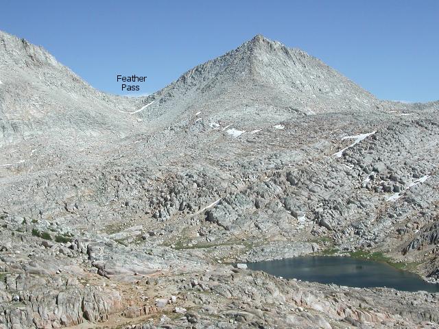
At the southern edge of Dancing Bear Pass, my eyes were treated to a dazzling view of White Bear Lake and White Bear Pass. My route was not completely obvious to me and I studied the map for a moment in order to choose a "best" direction to head off in. In Roper's guidebook, he describes Bear Lakes Basin as "a convoluted region where the long range visibility often is blocked by intervening ridges". I could not agree more. I found myself consulting the map every few minutes and taking a best guess to find the least obstructive way to my goal of Ursa Bear Lake. The complexity of the terrain was a bit of a surprise to me, as the basin had looked deceptively gentle on my map. The Bear Lakes are closely spaced, but further inspection of the map showed numerous contour lines, a fact that I had not noticed before.
 |
 |
 |
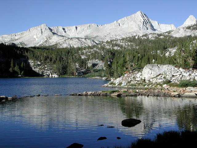
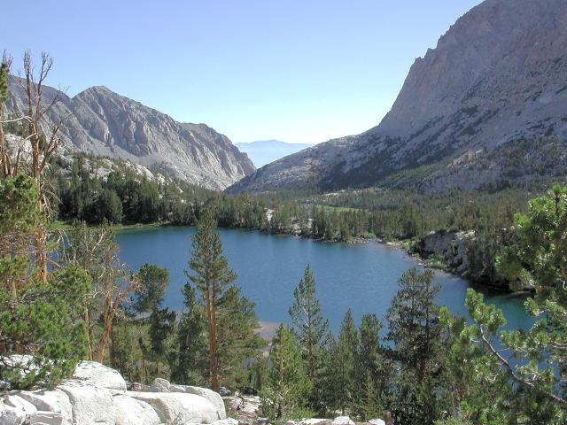
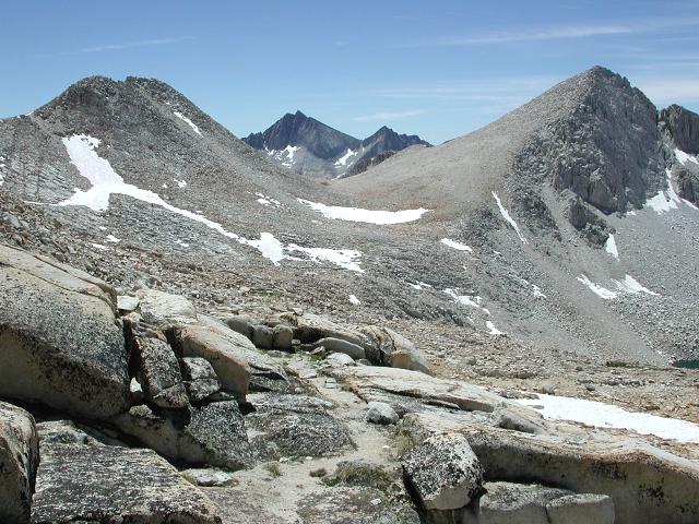
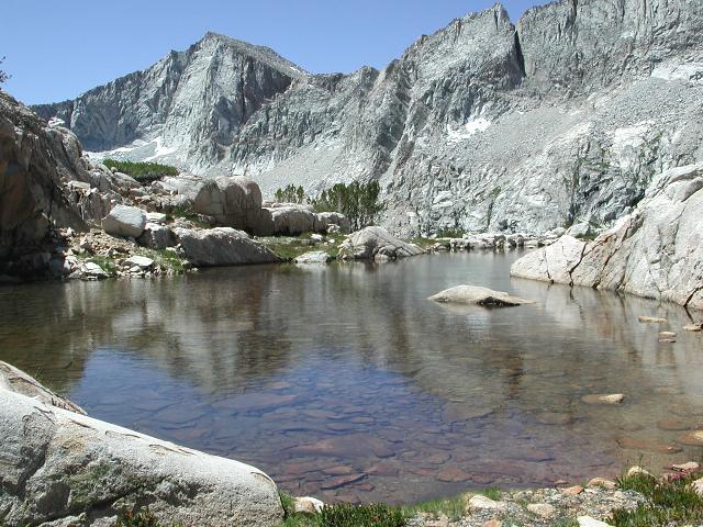
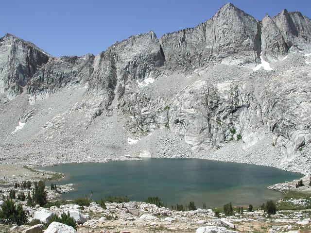
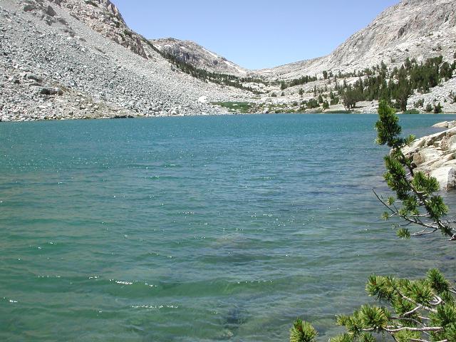
Ursa Bear and Bear Paw Lakes were visible in the distance, approximately a mile away. Feather Pass, which I would climb over the next day, was also in obvious view. I wound my way down one small ridge and up and down another until arriving at the shoreline of Big Bear Lake. Big Bear was quite scenic with the distinctive double summitted bulk of Seven Gables hulking in the background. It was then just a short climb up to Ursa Bear Lake and I soon found myself standing at its outlet. Darryl and Sue (from the Bay area) had recommended a nice campsite directly between Ursa Bear and Bear Paw Lakes, but I saw a group of 5 or 6 guys milling around that area several hundred yards away and assumed that they had occupied that recommended campsite. I soon located a nice site near the southwestern shore of Ursa Bear and plopped my tired body down for the night. It had been a bit breezy and slightly cool all day, but a side benefit was that there were no mosquitos. I made camp and did the obligatory chores of washing and cooking. The sky had been mostly cloudless all day and I was treated to a pleasant sunset with beautiful Ursa Bear Lake in the foreground and the sharp jagged edge of nearby peaks in the background.
 |
 |
 |
Day 2: Bear Lakes Basin to Humphreys Basin
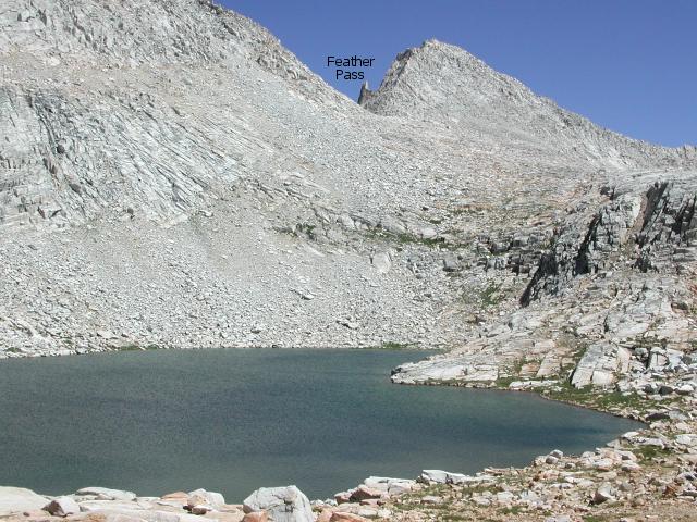
I slept in on my first morning out, not only because I was tired, but also to minimize the time that my camp was shaded before the sun peeked over the top of the peaks to the east. It had been a cool night and I was in no hurry to get out of the tent. I finally arose at 7am and the sun hit camp just a half hour later. It was another glorious morning in the Sierras. After breaking camp, I ambled my way eastward and passed Ursa Bear and Bear Paw Lakes along their southern shores. My immediate goal was Feather Pass, which was perhaps 1-1/2 miles away.
 |
 |
 |
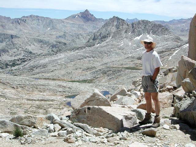
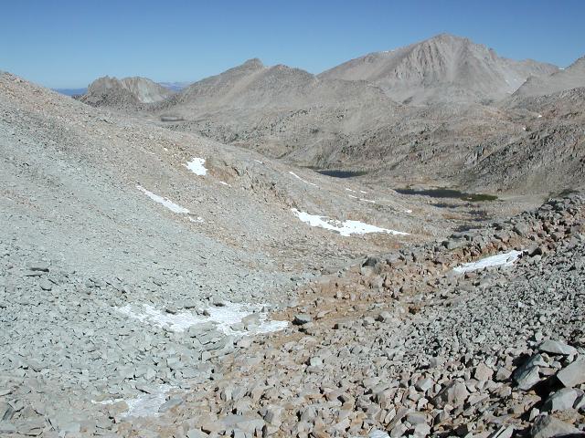
The climb to Feather Pass was not especially difficult, but my legs were still tired from the previous day's exertion and were slow to respond. Nevertheless, I persevered and after a short scramble just below the pass, I found myself standing in the pass at 10:00am. Following a short rest and several pictures, I walked down the south side of Feather through easy terrain until just above an unnamed lake, at which point the terrain steepened. After some deliberate route-finding, I was standing at the lake's shore and looking back at Feather Pass, now a half mile behind me. The southern side of Feather Pass looked reasonably gentle and gave no hint of the sharp dropoff that awaited the northbound traveller on its other side.
 |
 |
 |
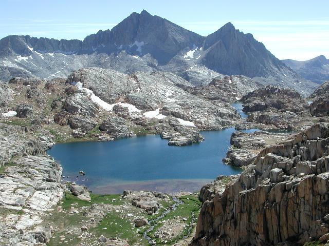
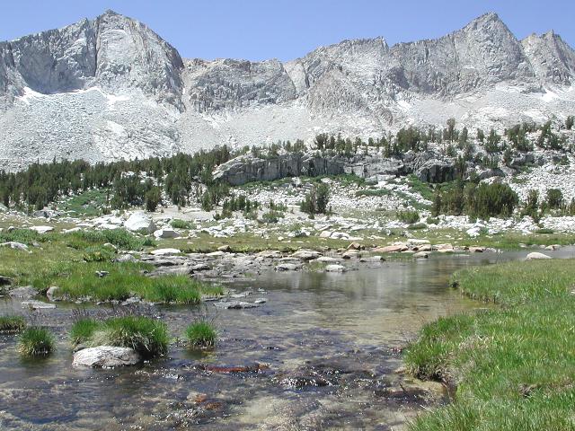
I wandered downhill through Meriam Lakes Basin alongside tall, picturesque peaks and through scenic meadows. This was just one more example of the High Sierra in all its splendor. After an hour walking through this wonderland, I came to a series of two long significant dropoffs, one that would bring me down to a beautiful meadow below Meriam Lake and another that would take me into the lowlands (10,000') of wooded French Canyon.
 |
 |
 |
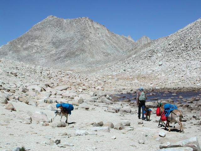
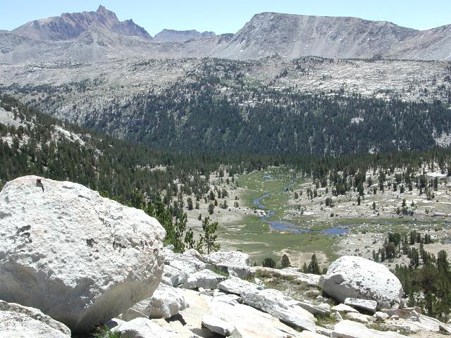
Easy walking down steep slopes brought me to the French Canyon Trail, where I encountered a backpacking couple coming down from Pine Creek Pass. I turned east and followed the trail upstream on a gradual uphill grade. It was noticeably warmer at this slightly lower elevation, but there was still no sign of mosquitos.
 |
 |
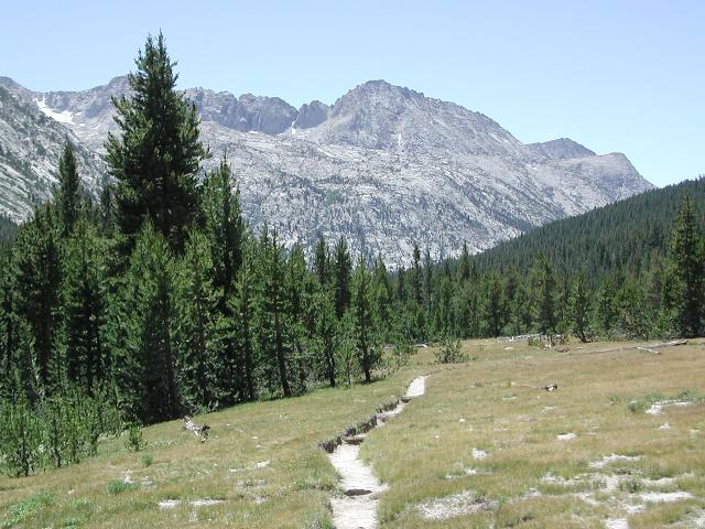 |
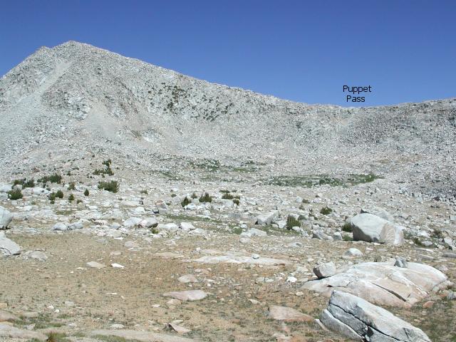
After following the French Canyon Trail gently uphill for a mile or so, I encountered the notable landmark of a noisy cascade of water, falling down a steep slope from Royce Lakes. Per Roper's guidebook, I crossed the stream in French Canyon at this point and began climbing the wooded slopes on up the canyon's south side, heading for Puppet Lakes. I was fairly tired at this point and struggling somewhat on the climb, nevertheless, after persevering for a half hour, I found myself standing in a meadow , wondering where Puppet Lake was located. No lake was seen from my present position. After consulting the map, I continued south up another slope and found myself standing beside lovely Puppet Lake. Puppet Pass was visible not far away and didn't look especially high or difficult.
 |
 |
 |
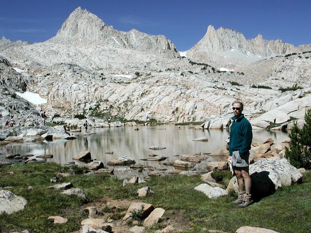
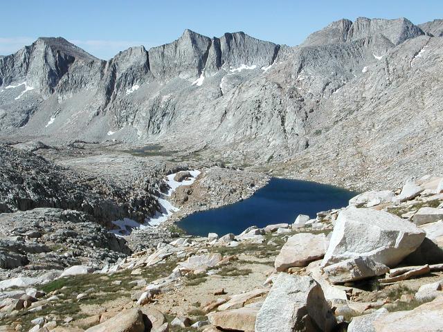
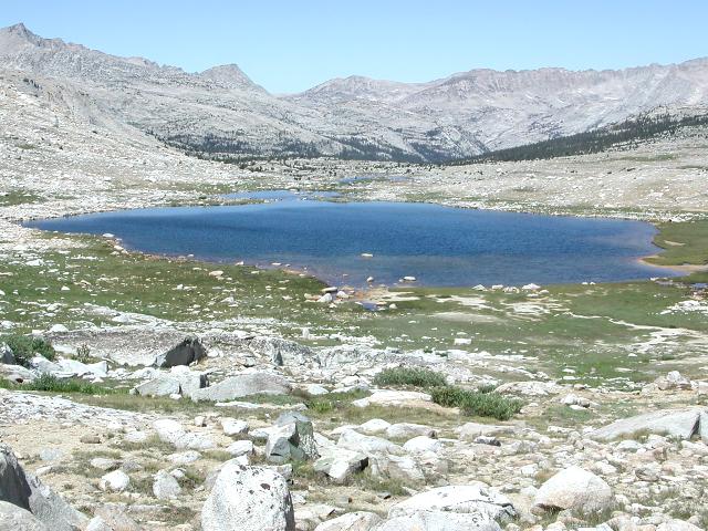
I passed by Puppet Lake on its southern shore and made my way toward the pass. The climb to this pass would not be overly long, but the slope looked uncomfortably steep and difficult. I followed a steep scree slope up the left, center until just below the pass. A short scramble brought me to the pass and a nice view of Puppet Lakes Basin. Thankfully, the south side of the pass was serene and gentle compared to the short but tiring steep climb I had just finished. I was tired and needed the rest of easy walking. Humphreys Basin was just ahead and I plotted a course toward Desolation Lake, which would be my home for the night.
 |
 |
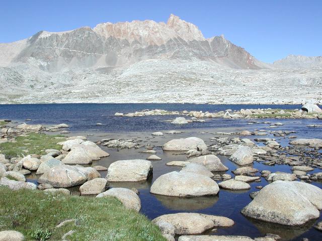 |
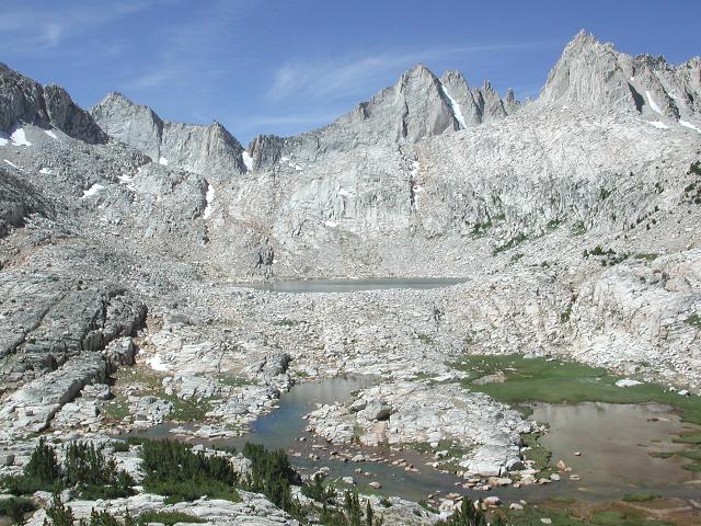
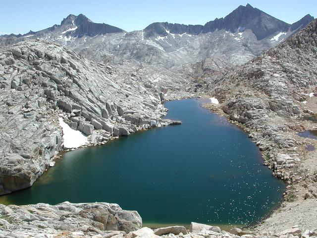
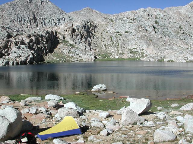
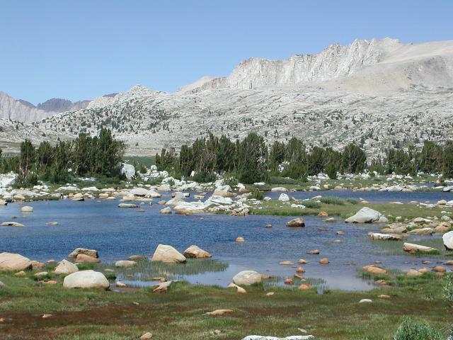
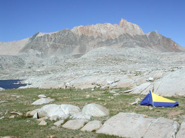
Easy walking brought me to Desolation lake and a nice campsite at the lake's southwestern shore. Magnificent Mt. Humphreys towered over the lake, my campsite and the entire basin. I contemplated whether this Mt. Humphreys was named for the same person whom Arizona's Mt. Humphreys was named for and assumed that it was. It was another spectacular evening in the High Sierra. I had plenty of time for camp chores (cooking and washing), although the moderate breeze and cool air made washing a bit uncomfortable. The sun set at 8pm again and I immediately felt cold and climbed into bed.
 |
 |
 |
Day 3: Humphreys Basin to North Lake
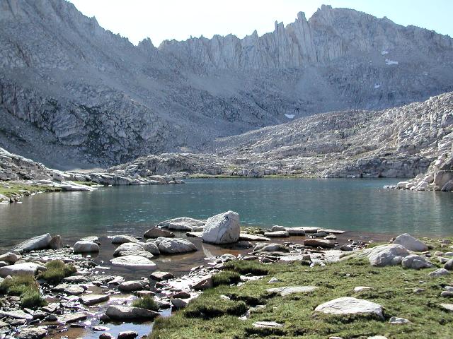
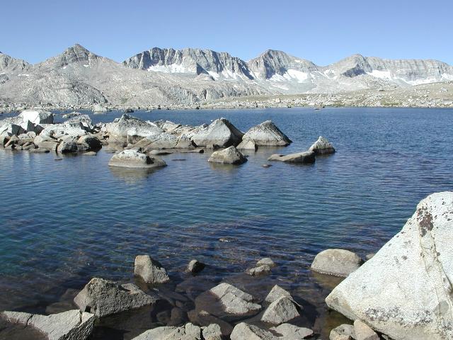
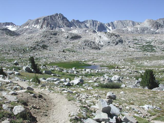
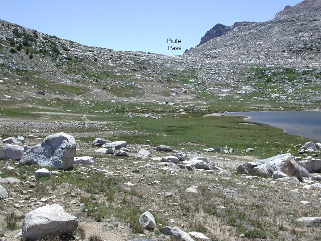
Day 3 dawned clear and sunny once again. I slept in again, waiting for the sun and was mildly surprised to find sunshine on my tent at 7:15am. I arose, broke camp and began wandering southerly across the basin. My next destination of Lower Desolation Lake quickly came into view. My original plan was to circle this lake on its western side, but I chose instead to pass along its eastern side with the hopes of better photo opportunities. This turned out to be a good choice, since the Glacier Divide shimmered brilliantly as a backdrop to the stunning lake. I moved slowly through this area, not only because of the tediousness of hopping along talus boulders, but also because of the many stops for pictures. Eventually, I wound up in Piute Canyon and found myself on good trail and heading east towards Piute Pass. it felt good to be walking on easy trail again. I arrived at Piute Pass within an hour and shared the pass with a dozen other people, which was a bit of a shock after the relative isolation of the off-trail backcountry. I could not help but reminisce of a 1996 previous trip, when I visited Piute Pass in the company of my mom and dad on day 2 of an 8 day loop through Evolution Basin.
 |
 |
 |
After relaxing in the pass for nearly an hour, I meandered eastward past Piute Lake, Loch Levin and toward the end at the Piute Trailhead. I encountered many other hikers along this section, most struggling uphill, but all happy and having fun. It was good to be walking downhill on easy trail, although this trail was quite dusty and almost as treacherous as boulder hopping through the off-trail backcountry. I took my time and watched my step. Finally, at 2pm, I reached the end of the trail, walked the final 15 minutes to my car and took off my pack for the last time. It had been another Sierra Spectacular!
 |
 |
 |
 |