 |
The Royal Arch Route, 2002 |
Click on any image to enlarge.
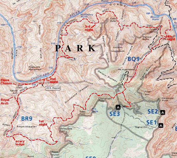
The Royal Arch Route is a 45-mile loop in western Grand Canyon National Park that leads to a large, natural stone arch in Royal Arch Canyon. Below the arch, at the foot of Royal Arch Canyon, lies scenic Elves Chasm, a picturesque oasis that is a favorite stopping place for river rafters. The Royal Arch and Elves Chasm are both worthy destinations for a Canyon trip. Lying in wilderness zones, the Canyon traveller is unlikely to see other humans on this loop.
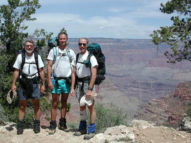
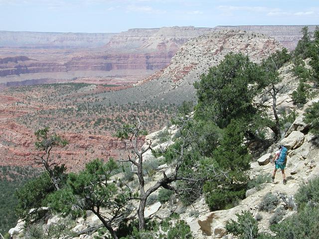
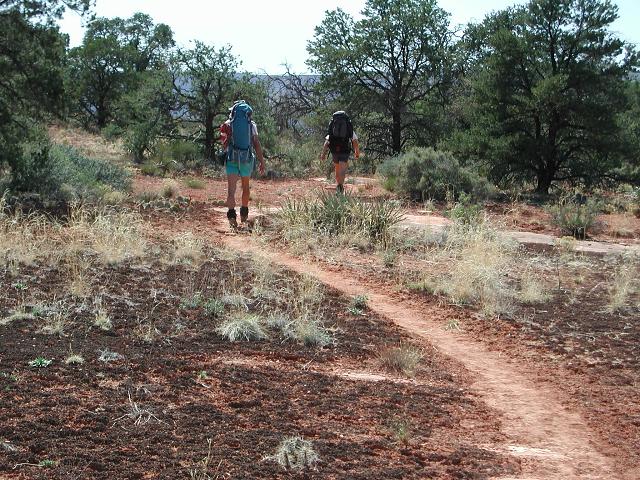
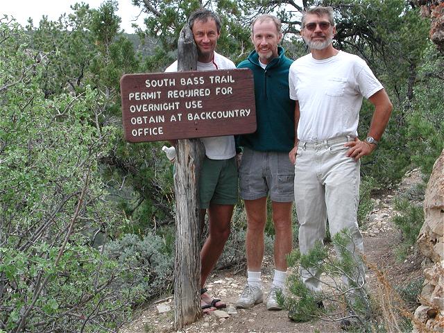
Doug Minderlen, Greg Reinhart and myself (Dave Wyant) departed Phoenix on Thursday morning and drove to the Grand Canyon. The 215 mile trip to the Canyon plus the 29 mile excursion to the South Bass trailhead, our starting point, took approximately 5 hours. We entered the Canyon on the South Bass trail in the early afternoon. After descending to the Darwin Plateau, 1000' below the rim, we turned west and traversed for several miles below the rim, maintaining a nearly constant elevation. By the end of the day, we had travelled 6 or 7 miles to the far edge of the Drummond Plateau. We made our first night's camp near a drainage that would lead us into Royal Arch Canyon the next morning.
 South Bass trailhead |
 Descending the South Bass |
 Crypto-biotic soil |
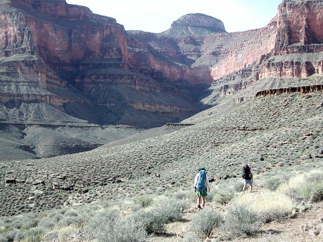
 Greg surveys the descent |
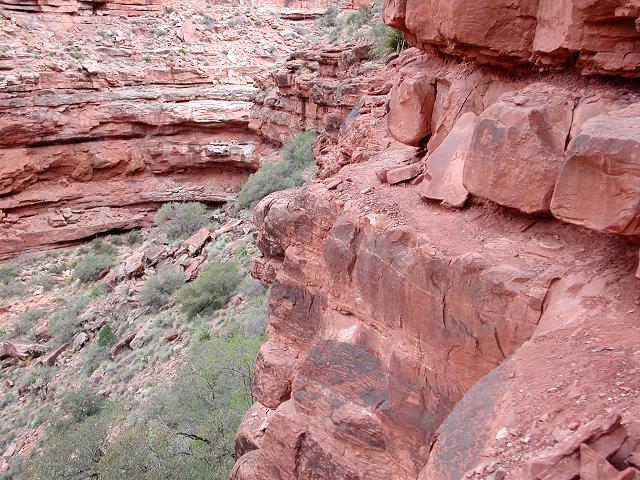
On Day 2, we awoke to a clear dawn, packed up, and began the descent into Royal Arch Canyon. This part of the journey was easy walking down the middle of one of the arms of Royal Arch Canyon, following the occasional cairn. As we neared Royal Arch Canyon itself, we came to a large pouroff that we could not negotiate. Cairns marked a route along the left wall of the canyon that eventually ended on a narrow ledge. On our previous trip (Sept, 1995), Greg and I had rappelled off the ledge to the canyon floor at this spot, a drop of about 40'. Today, we could not easily find a safe anchor for the rappel. We instead elected to lower our backpacks over the edge, then carefully traverse the scary ledge without packs. Although it was a little spooky, we all made it across safely.
 Ledge with 40' dropoff |
 Greg traverses the scary ledge |
 More of the ledge beyond the traverse |
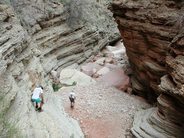
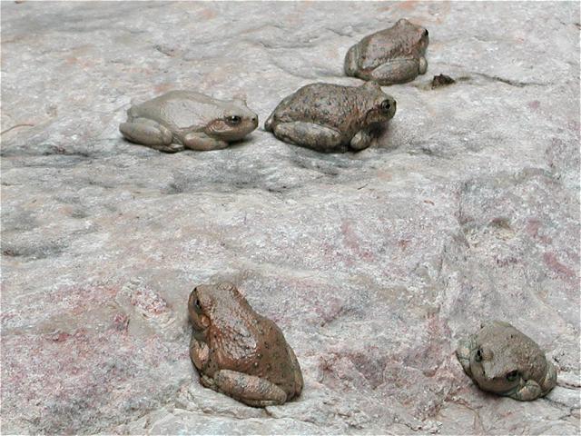
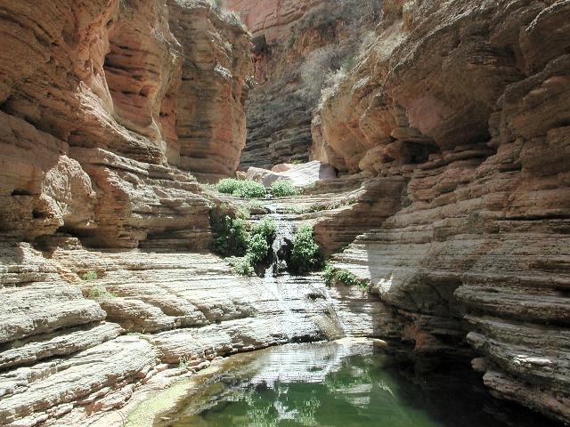
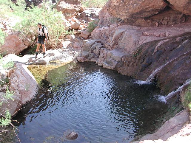
Shortly after the traverse along the ledge, we entered Royal Arch Canyon and boulder-hopped our way downstream toward the Royal Arch. This canyon was dry, but just before we arrived at the arch, we encountered large pools and lots of flowing water, evidently from a spring. The canyon suddenly became alive with the sound of trickling water and croaking frogs. Fourteen frogs sat on one large rock, sunning themselves.
 Royal Arch Canyon |
 Alongside a pool |
 Some of the 14 frogs |
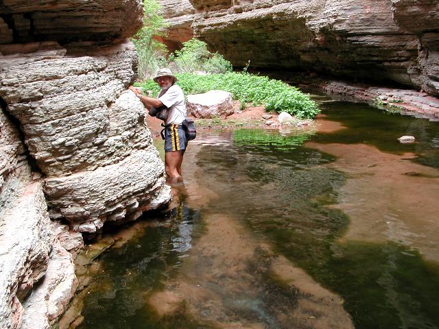 Doug wades a pool |
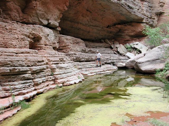
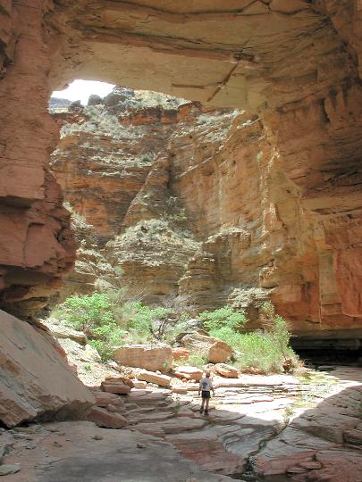
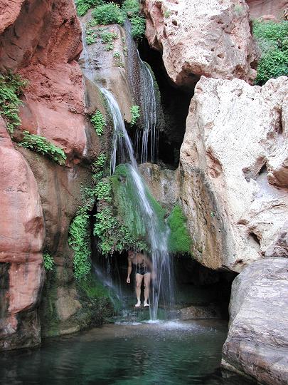
We rounded a corner and came to the arch. The Royal Arch is a thick, stone, natural arch lying in lower Royal Arch Canyon, about a mile short of the Colorado River. The route down-canyon to Elves Chasm and the Colorado River is blocked by a 200' waterfall. We cooled off in the water and enjoyed an hour of rest at this beautiful location.
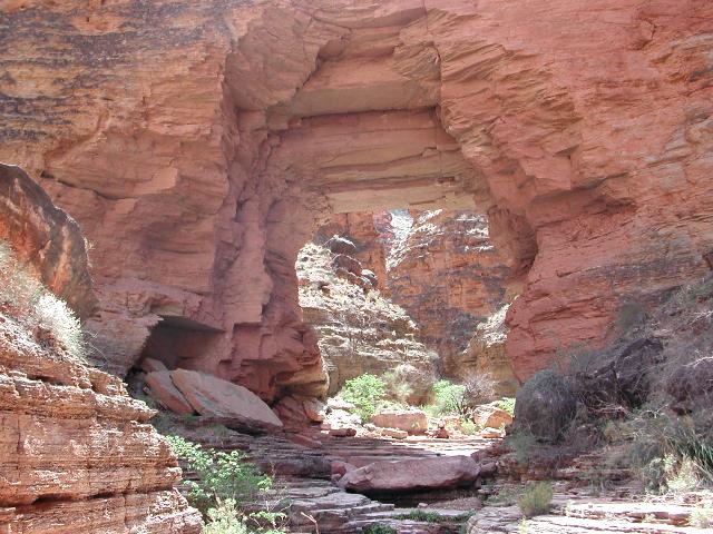 The Royal Arch |
 |
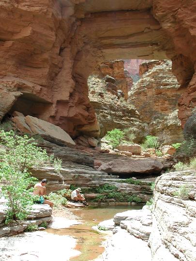 |
 Cooling off near the Arch |
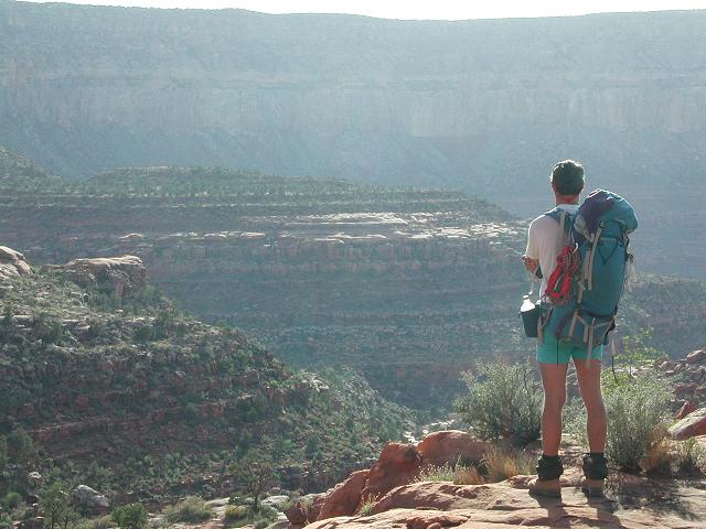
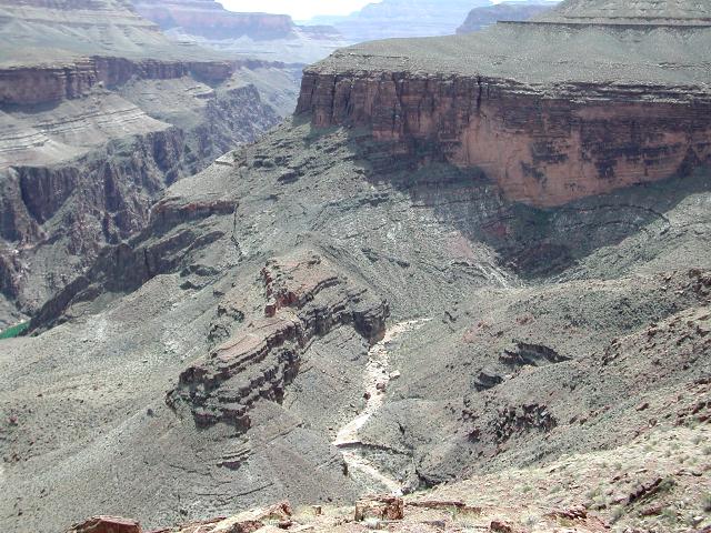
After relaxing at the Arch, we filled up on water and bid farewell to this unique corner of the Grand Canyon. We backtracked a half mile up the canyon to an exit trail that climbs out on the eastern wall of the canyon. A short climb brought us to the upper edge of the canyon wall and we walked north, following the brink of the canyon, back toward the river. The trail flirted with the edge of the Royal Arch Canyon and provided dizzying views to the canyon floor, a few hundred feet below.
 Scenic Royal Arch Canyon |
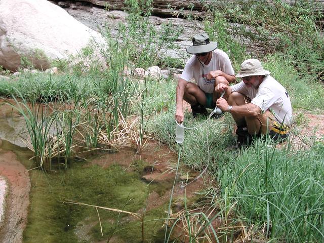 Filtering water |
 Above the Arch |
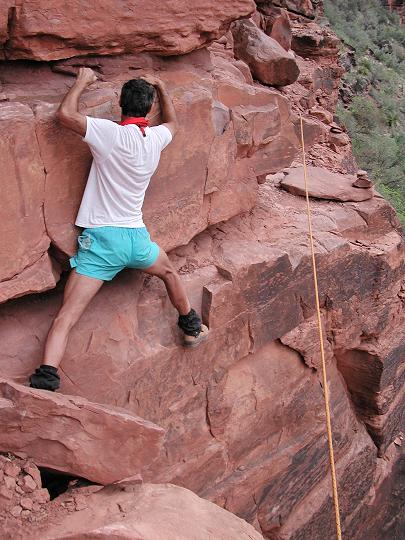
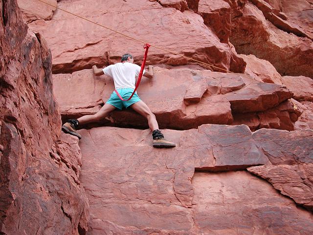
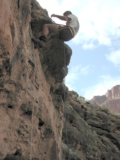 Doug on rappel |
Finally, our trail veered away from Royal Arch Canyon and traversed generally eastward, somewhat paralleling the river,
but also gradually working toward it. After a mile, we approached a dropoff that would descend to the river on steep terrain,
requiring a rappel in one place to negotiate a 20' cliff. Shortly thereafter, we found ourselves beside the Colorado River
and the location of our second night's camp.
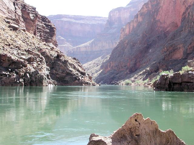
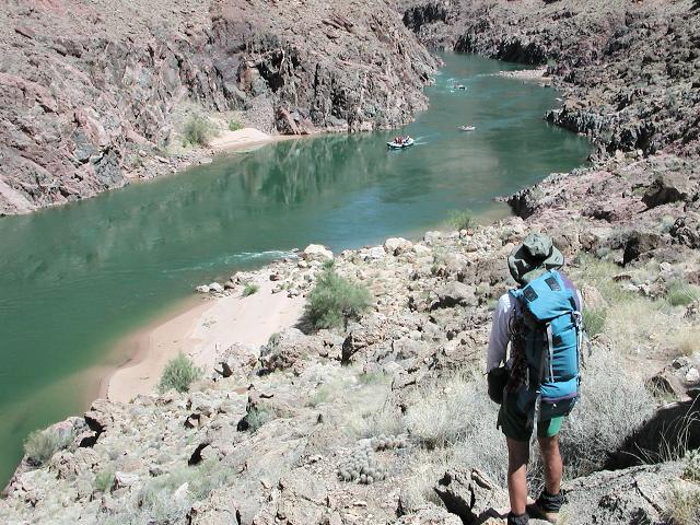
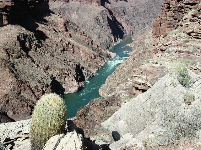
Sometimes the river runs muddy brown and sometimes it runs clear green, depending largely on the rate of water release at
Glen Canyon dam, nearly 100 miles upstream. When muddy brown, the water is acceptable for drinking, but is not pleasant
as the mud is nearly impossible to filter out. Usually overnight settling is required. Throughout this trip, the river
remained green and the water was delightful for drinking (after filtering).
 The Colorado River |
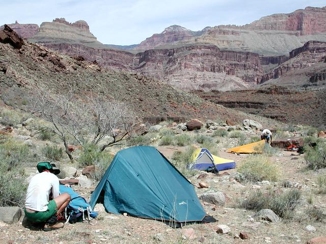
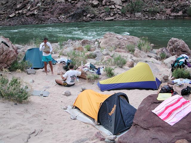 Second night's camp |
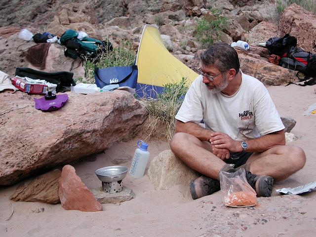 Cooking |
That night, we were treated to a flash lightning display, followed by light rain. We were in our tents when the rain started and were able to easily drift off to the mild pitter-patter. The next day dawned, sunny, clear and dry. Doug and I arose early for the short side trip to Elves Chasm, approximately 1-1/2 miles downstream. Greg elected to sleep in since he had already been there on three previous occasions. Elves Chasm is a pristine oasis at the mouth of Royal Arch Canyon, featuring constantly flowing water and super-scenic waterfalls and pools. After an hour of picking our way along a rudimentary trail, we arrived at Elves Chasm and enjoyed the scenery as well as several dips in the pools.
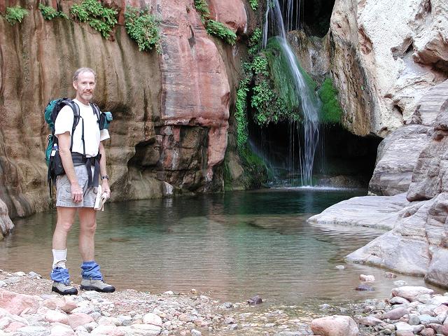 Scenic waterfall and pool in Elves Chasm |
 Doug braves the cold pool |
 Hey Dave! Here's another pool! |
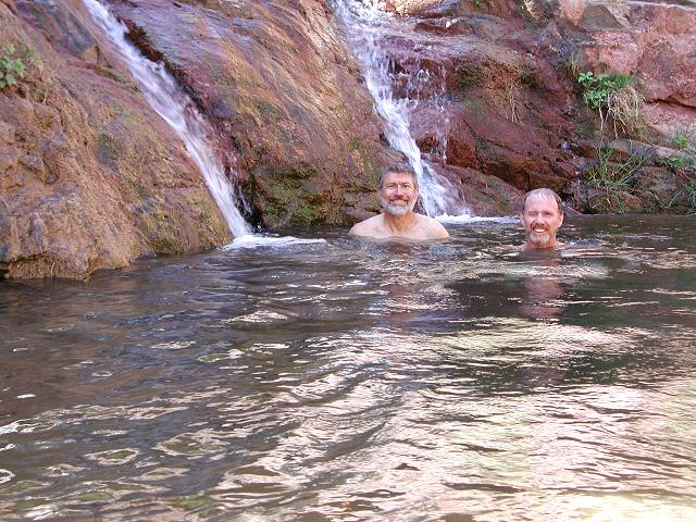 A dip in the second pool |
After two hours in the scenic wonderland of Elves Chasm, we worked our way back to camp where Greg was relaxing on the beach, awaiting our return. We loaded up our packs and turned east, following a trail that gradually climbed, paralleling the river. At Garnet Canyon, which marks the western terminus of the 95-mile Tonto Trail, we played in a salty pool and enjoyed our last water source for the next 24 hours. The remainder of the day and the first half of the following day would be spent up on the hot, dry Tonto Platform, walking on the Tonto Trail. We languished in the water, then proceeded on our way, feeling refreshed.
 Greg eyes river runners |
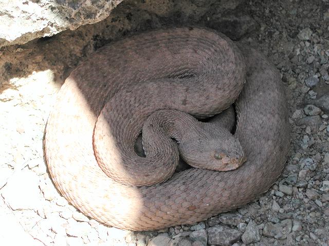 A dozing rattlesnake |
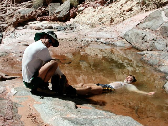 Cooling off in Garnet Canyon |
 Climbing out of Garnet |
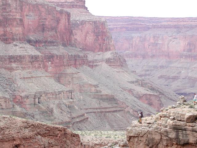
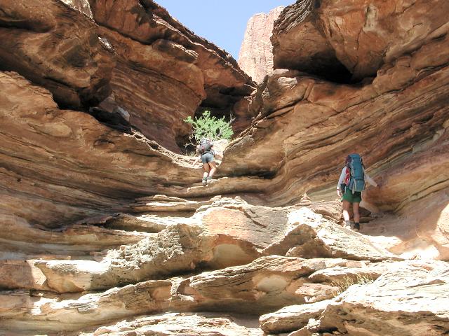
We followed the Tonto Trail for another 4 miles to an unnamed side canyon above Walthenberg Rapids on the river. This would be our home for our 3rd night on the trail. The next morning, Day 4, we packed up and continued walking along the Tonto. Passing though Copper Canyon on our way to Bass Canyon, our destination for the day.
When we arrived at Bass Canyon, we were hot and dry in the mid-day sun. The thermometer read 96 degrees and we had been conserving water, since our last night was a dry camp. We hurriedly made camp, then strolled down the South Bass trail to spend the remainder of the day relaxing beside the cool Colorado River. Being hot, dry and parched, we were somewhat giddy with anticipation of cooling off in the river.
 The river below |
 Third night's campsite |
 Entering Copper Canyon |
 Bass Canyon |
 Campsite in Bass Canyon |
William Bass developed a tourist camp on the South Rim and a winter camp and mines on the north side of the Colorado River.
He made the Bass trail by improving the Indian footpaths to make them suitable for horseback travel. Initially, he guided sightseers
across the river by boat and then by cable crossing to reach his trail leading to the North Rim. To do laundry during dry spells,
his wife, Ada Bass, would bundle up the family's dirty clothes and saddle her horse for a 3-day trip to the river and back.
An old metal boat, the Ross Wheeler, lies at the foot of the South Bass trail, abandoned by a river party in 1915.
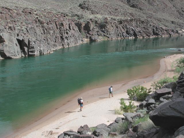 Sandy beach |
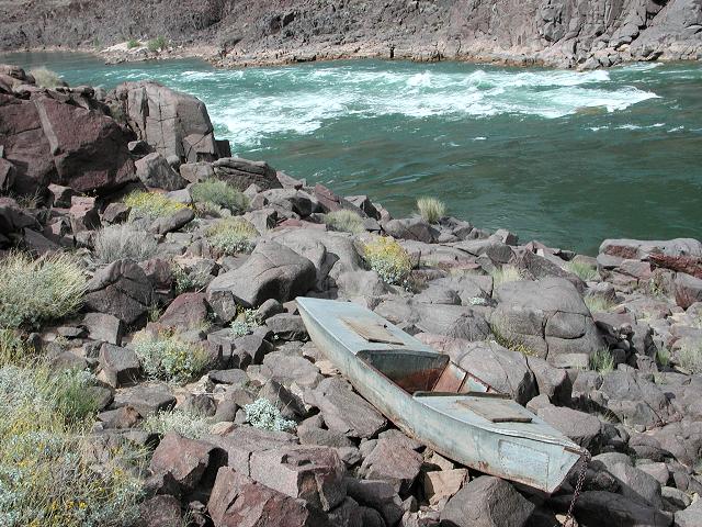 Boat at Bass Rapids |
 Celebrating the river |
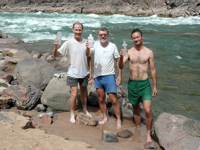
We stayed by the river for the afternoon, even cooking our evening meals there. Before heading back to camp, some 1-1/2 miles up
trail and 600 vertical feet above us on the warm, dry plateau, we topped up our water containers and jumped in the river again for
one last cooling off. Feeling refreshed, we trudged back up the trail and arrived back at camp right at sunset.
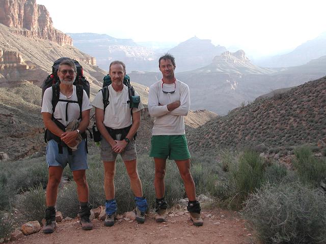
The next morning, we arose early, broke camp and climbed out the South Bass trail to the South Bass trailhead, where we had started
our journey 4 days before.
 Climbing out the South Bass |
 South Bass trailhead |