 |
The Nankoweap Trail, 2002 |
Click on any image to enlarge.
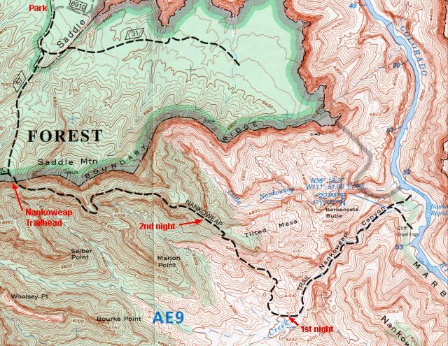
The Nankoweap Trail is an 11 mile rim-to-river trail located in the northeast corner of Grand Canyon National Park. This North Rim trail can be reached by one of two forest roads, FS610 or FS8910. Either access point requires an additional 3 to 3.5 mile walk to the rim and the true beginning of the Nankoweap Trail, thus the entire hiking distance from vehicle to the Colorado River is 14-14.5 miles. At 8800' elevation, the FS610 access point is 1200' higher than Nankoweap trailhead whereas the FS8910 access, at 6800' elevation, is 800' lower than the trailhead. We opted to begin at the FS8910 access, not only because it would provide a downhill walk from the trailhead after climbing to the rim at the end of our hike, but also because it is a shorter drive from Phoenix.
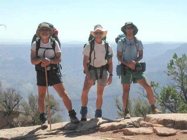
Doug Minderlen, Greg Reinhart and myself (Dave Wyant) departed Phoenix on Wednesday, September 11, 2002 and drove the 290 miles to the trailhead in just under 6 hours. Not knowing much about FS8910, we travelled in a 4WD vehicle just in case the road was difficult to negotiate after the recent northern Arizona rains. We were pleasantly surprised to find this forest road well-graded and in excellent shape, requiring only 50 minutes to navigate the 27 miles to the parking area where we would begin hiking the next day.
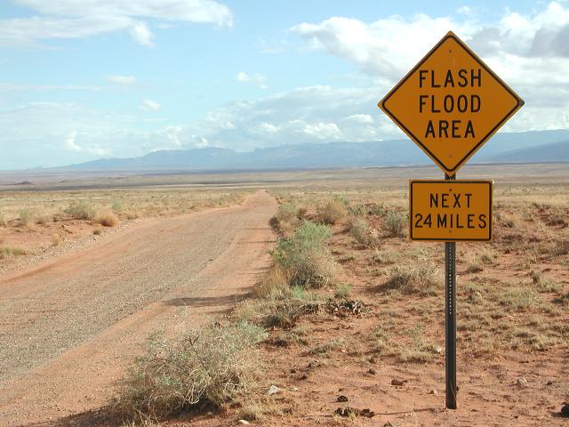
On Thursday morning, we arose and began the 3-1/2 mile walk to the trailhead following forest trail #57 uphill toward Saddle Mountain, which is located on the Canyon rim. Most of the 800' of elevation gain along this trail came in one vigorous push, just before the rim. After 1-3/4 hours, we reached the rim and the Nankoweap trailhead, already somewhat tired from the climb. After a short rest, we were ready to go. Its all downhill from here!
 27 mile dirt road |
 Trail 57 leads to the rim |
 Rim view at trailhead |
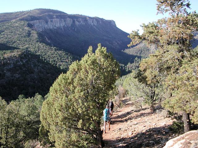
Nankoweap has a reputation for being one of the most difficult and scariest trails in the Grand Canyon. This was our first time on this trail and we were unsure what to expect. We had read lots of trip reports from various groups regarding this trail and many extolled the dangers of the long traverse below the canyon rim, as well as the difficulty of the long descent from Tilted Mesa down to Nankoweap Creek. Many reports recommended not attempting to hike all the way from vehicle to Nankoweap Creek in one day, as being too long and hard. Other reports, including a 1996 Arizona Highways article, told of aborted attempts where hikers had chosen to turn back. The three of us have many Canyon miles to our credit and have put in long days on Canyon trails. We were somewhat apprehensive, yet also not truly expecting Nankoweap to be significantly more difficult than other trips we had been on. Our plan of an 11 mile hike from our vehicle to Nankoweap Creek seemed reasonable to us.
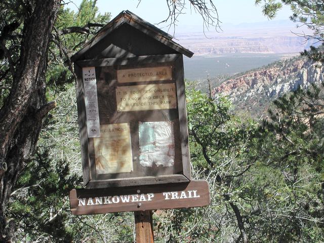 Nankoweap trailhead sign |
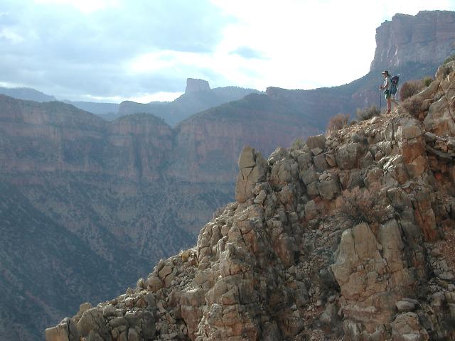
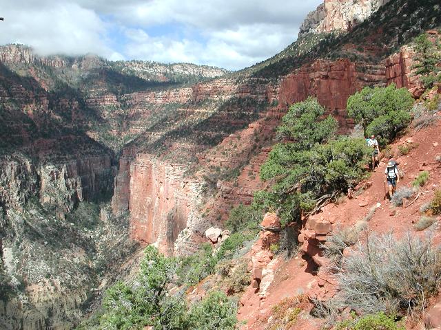 Start of the long traverse |
 Walking along the edge |
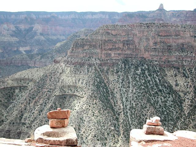
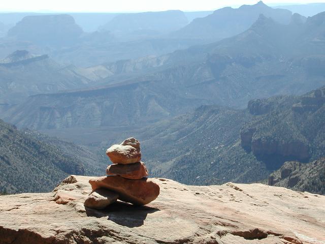 Trailside Cairn |
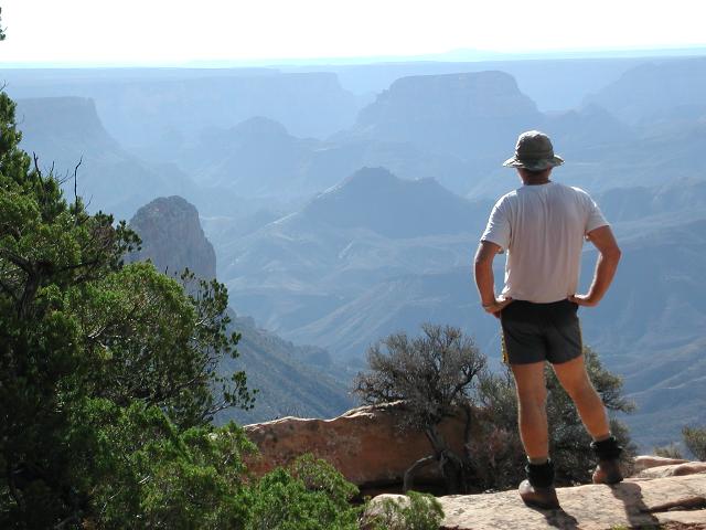
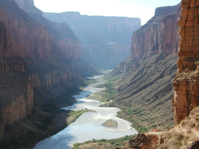
After an hour of traversing below the rim, we arrived at Marion Point and stopped for a break. We had just passed one semi-scary spot along the trail and were debating amongst ourselves as to whether that was the infamous scary spot we had read about in various trip reports. It was a bit scary, but not horribly so. After leaving Marion Point and traversing for another 1-1/2 hours, including another semi-scary spot, we arrived at a magnificent viewpoint above Tilted Mesa. To the south lay Tilted Mesa and the vast Nankoweap drainage far below. To the east lay the major drainage of Little Nankoweap Creek. We stopped, enjoyed the view, and prepared ourselves for the torturous descent we had read about.
 View above Tilted Mesa |
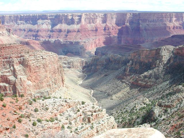 Little Nankoweap Creek |
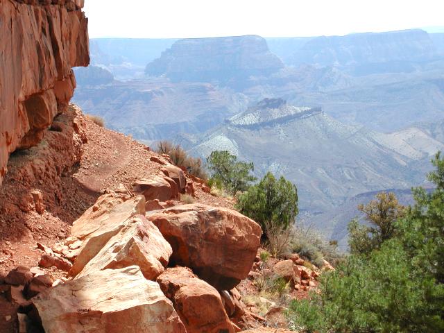
 Jumpoff point |
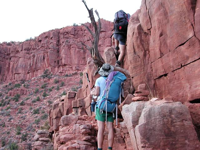
 Descent from Tilted Mesa |
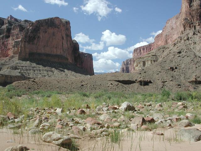
The descent from Tilted Mesa to Nankoweap Creek was indeed long and steep, however, nowhere did we find any areas where we needed to either lower our packs or slide on our butts, as some trip reports had led us to believe might be necessary. The occasional shale and scree was very steep, but manageable. After 1-1/4 hours, we arrived alongside Nankoweap Creek and its gently flowing stream. It was only 2:30pm and we had plenty of time to rest and look around for suitable campsites. The creek itself was a shallow trickle, just a couple of feet wide, and provided no swimming opportunities as we had hoped. Nevertheless, we were able to splash around in its refreshing waters to cool off. A few dark clouds were roaming the sky and our weather forecast had been mixed before we left home. One forecast called for 40% chance of rain along the Grand Canyon north rim. We felt uneasy about the safety of the established streamside campsites since they were low and near the water's edge. They appeared to be susceptible to possible flooding, so we hauled our packs back up to the plateau 50' above the creek and made our camp there.
 Nankoweap Creek |
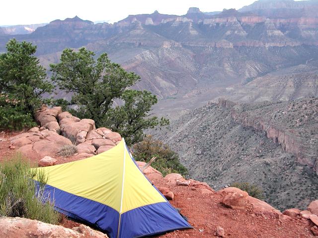
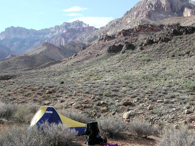 First night's campsite |
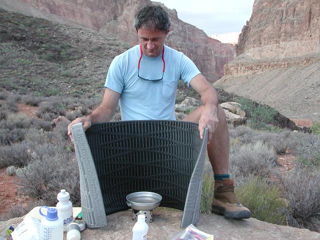 Cooking |
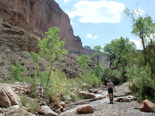
On Friday morning, Doug and I began the 3 mile trek down Nankoweap Creek to see the Colorado River and the Anasazi granary located above the river. Greg elected to stay around camp and relax beside the stream. After 1-1/2 hours of leisurely walking, we arrived at the river and climbed high up its western bank to explore the Anasazi granary. The granary provided a stunning view down the Colorado River as it flowed picturesquely through the Granite Gorge.
 Colorado River downstream |
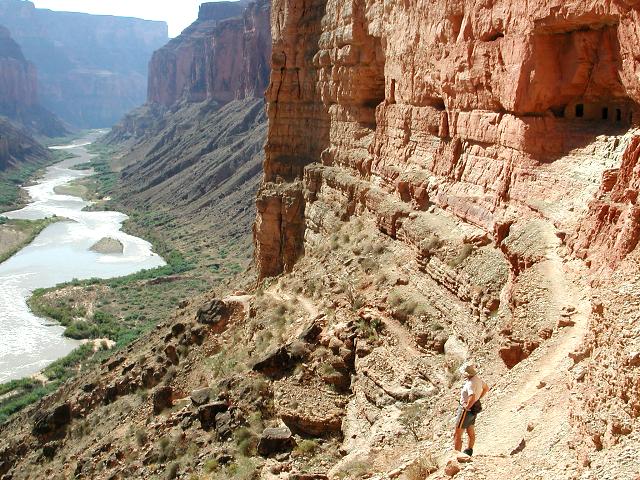 Climb to the Granary |
 At the Granary |
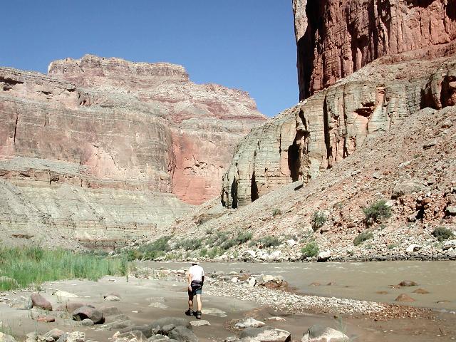
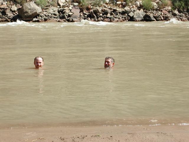
By now the day had warmed and we were feeling the hot sun. After descending from the granary, we walked to the river's bank for a much anticipated dip in its chilly waters. That water is COLD! We alternately ran in, dunked ourselves, and ran back out again. As soon as the pain from the frigid water had subsided, we repeated the act, again and again, until the heat had nearly left our bodies and we were standing in the warm sun with our teeth chattering. Doug proved to be the manliest of the two of us and was able to remain submerged for a much longer time (30 seconds) than I. Feeling refreshed, we began a lazy walk back up Nankoweap Creek to camp.
 Walk to the river |
 A dip in the COLD river |
 The Nankoweap delta |
 Head back to camp |
We arrived back at camp around 1pm, relaxed for awhile, then packed up our gear and prepared to leave. Our plan was to get the long climb up to Tilted Mesa out of the way and to spend the night high up at a campsite that was renowned for its good view. We would have a dry camp, so we filled all of our water-carrying containers to capacity, since whatever we now carried would have to last throughout the climb, the evening at our dry camp, and the hike out the next day.
 The climb to Tilted Mesa |
 High on the climb |
 Greg takes in the view |
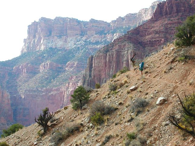
The climb to Tilted Mesa did not disappoint us in its difficulty. The trail is steep and challenging! Clouds were building and a storm was brewing, so we did at least have relief from the late summer sun. Along the way, we were treated to a short, but invigorating thunderstorm that lasted only about 10 minutes, which was just enough to cool us off and to distract us from the effort at hand. Doug, who always likes a challenge, admitted later that he was laughing out loud with glee at the storm, the effort, his burning quads, and the intensity of the climb. After two hours of steady climbing, we topped out on Tilted Mesa and then climbed a final 20 minutes to our high campsite, which did indeed provide a fine view. The storm left as quickly as it had arrived and the sky cleared for good. That evening, we enjoyed clear skies, a beautiful quarter moon, and lots of stars.
 Scramble up a short ledge |
 Second night's camp |
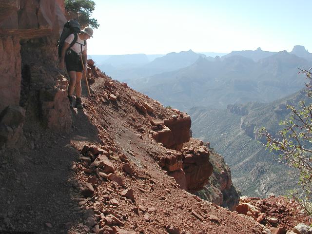
 View from the traverse |
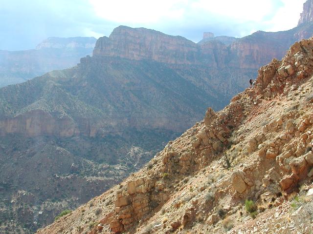
Following a peaceful night at our high campsite above Tilted Mesa, we packed up one last time and began the long traverse back to the trailhead. We were somewhat tired after yesterday's difficult climb and in no particular hurry. The traverse trail is somewhat undulating in nature. It doesn't really change much in elevation, yet the trail typically goes up 3 feet, down 3 feet, up 10 feet, down 10 feet, and so on. We plodded along the trail to Marion Point and then on to its exit at the rim. After a half hour break at the scenic trailhead viewpoint, we strolled the final 3-1/2 miles back to our vehicle at the parking area, cleaned up, and drove back to Phoenix.
 Continuing the traverse |
 Doug at the 'scary' spot |
 Back at the rim |
Nankoweap lies in a beautiful corner of the Canyon and sees little foot traffic. The trail is difficult and is a bit spooky in places, but neither the difficulty nor the fear factor completely lived up to its considerable hype. One could certainly fall to his death if a slip occured at the wrong place, yet there really are very few such places along the trail. The arduous climb to Tilted Mesa was quite strenuous, but all climbs out of the Canyon require a significant amount of effort. The character of the climb, however, with its steep grade, excellent views, and edge-of-a-mountain feeling, was possibly the most fun and enjoyable part of the trip, as were the views from our high, dry camp above the mesa. Nankoweap is memorable and we will likely be back one day.