 Our Honeymoon
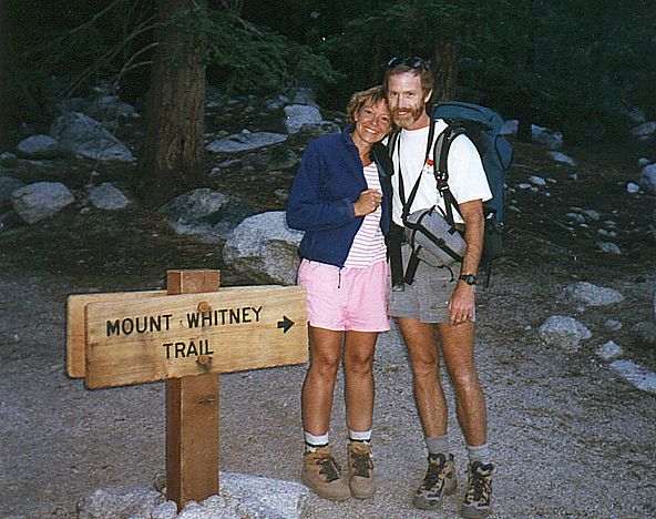
Part 2, Mt. Whitney, California
 |
Near the end of our two-week road trip through Nevada, California and Oregon, we made our final stop in central California near the small town
of Lone Pine, for a dayhike on Mt. Whitney. This page contains photos from the Whitney hike.
Go to |
Click on any image to enlarge.
Mt. Whitney, California Our last stop and the grand finale of our trip was a dayhike to the summit
of Mt. Whitney. The challenging trail entails 6100' of elevation gain over 10.7 miles (21.4 miles round-trip) and makes for a very long day.
The reward is a spectacular view from the 14,497' summit. Mt. Whitney is the highest mountain in the contiguous 48 states and amazingly lies in the
same county as Death Valley, which at 282' below sea level is the lowest point in the United States.
The Whitney trail climbs steadily along a manageable grade throughout its 10.7 mile length. The first 4 miles wanders through gradually decreasing forest until the last tree is left behind just below Trailside Meadow.
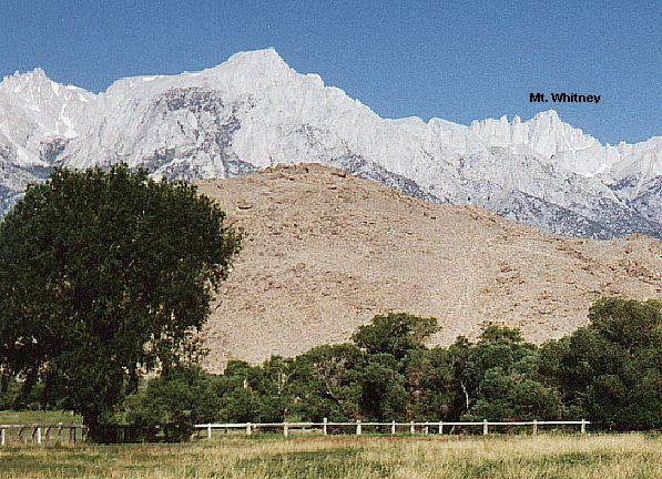 Mt. Whitney, as viewed from Lone Pine |
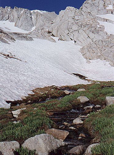 Trailside Meadow, just above treeline |
The Whitney trail is well-graded and well-used. The number of hikers is controlled by a permit system that allows 50 backpackers and 150 dayhikers to enter the wilderness each day. By preventing excessive overcrowding of the trail, the fragile alpine environment is less damaged and each hiker enjoys a higher quality trip.
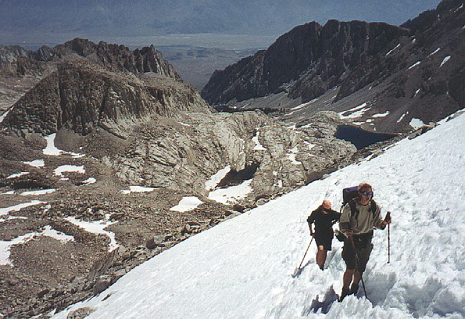 Hikers crossing a snowfield, just below Trail Crest Pass |
 The Whitney trail crosses to the West side of the mountain at 13,777' Trail Crest Pass and meets the John Muir Trail. |
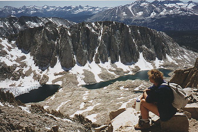
The summit ridge offers incredible views into the Sierra backcountry, which beckons with snow-capped peaks and pristine lakes. Mt. Whitney's summit provides dazzling vistas in every direction. The stone Smithsonian hut was built in 1915 to house scientists studying the suns rays. In 1990, a hiker was killed by lightning while huddled inside this hut, seeking shelter from a storm. Dave happened to be here two weeks prior to that death and also huddled inside the hut, seeking protection from a light rain (no lightning). Extensive efforts have since been made to electrically ground the hut and lessen its susceptibility to lightning penetration, although safety during a lightning storm is still not guaranteed.
 West side view along the trail. |
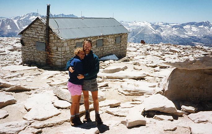 The stone Smithsonian hut provides summit shelter. |
The weather at the top is often surprisingly hospitable thanks to the warm sun and frequently calm winds. It is not uncommon to see hikers lounging around in T-shirts and shorts -- hardly what one would expect at 14,497'. Marmots and rosy finches inhabit the summit and beg for food. Being used to hikers and handouts, they will often eat from your hand.
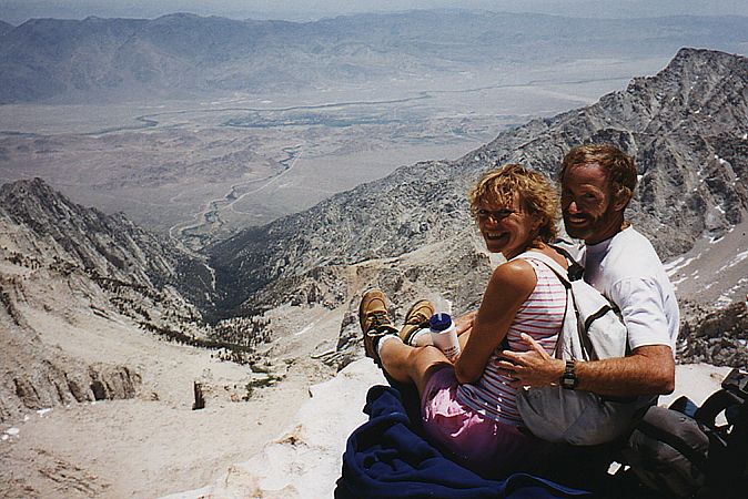 East summit view. Lone Pine lies in the distant valley, 20 miles away and 11,500' lower in elevation. |
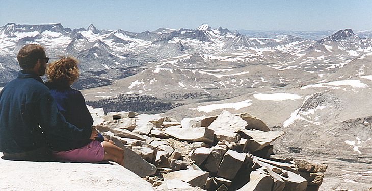 Looking Northwest from the summit into the vast Sierra backcountry. |
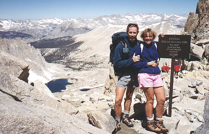
 The end of a long day |
We began our hike by flashlight in the dark at 4:30am and finished near dusk at 7:45pm. In the pre-dawn hour, a bat flew out of a bush(?) and hit Cindy in the head, startling us both. We met and made friends with other hikers along the way. One couple remarked that we acted "like we were on our honeymoon", which of course, we were. After more than 15 hours and nearly 22 trail miles and having successfully summited, we were tired, but elated. |
Go to Part 1 of our honeymoon, which has photos from other honeymoon destinations.